


Voting District 0200037, Suffolk County, New York
About
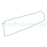
Outline

Summary
| Unique Area Identifier | 636830 |
| Name | Voting District 0200037 |
| County | Suffolk County |
| State | New York |
| Area (square miles) | 0.31 |
| Land Area (square miles) | 0.31 |
| Water Area (square miles) | 0.00 |
| % of Land Area | 100.00 |
| % of Water Area | 0.00 |
| Latitude of the Internal Point | 40.95130500 |
| Longtitude of the Internal Point | -72.96693310 |
Maps


Graphs
Select a template below for downloading or customizing gragh for Voting District 0200037, Suffolk County, New York


Neighbors
Neighoring Voting District (by Name) Neighboring Voting District on the Map
- Voting District 0200066, Suffolk County, NY
- Voting District 0200098, Suffolk County, NY
- Voting District 0200135, Suffolk County, NY
- Voting District 0200248, Suffolk County, NY
- Voting District 0200260, Suffolk County, NY
- Voting District 0200267, Suffolk County, NY
Top 10 Neighboring County Subdivision (by Population) Neighboring County Subdivision on the Map
Top 10 Neighboring Place (by Population) Neighboring Place on the Map
Top 10 Neighboring Unified School District (by Population) Neighboring Unified School District on the Map
- Rocky Point Union Free School District, NY (17,907)
- Miller Place Union Free School District, NY (15,859)
Top 10 Neighboring State Legislative District Lower Chamber (by Population) Neighboring State Legislative District Lower Chamber on the Map
Top 10 Neighboring State Legislative District Upper Chamber (by Population) Neighboring State Legislative District Upper Chamber on the Map
Top 10 Neighboring 111th Congressional District (by Population) Neighboring 111th Congressional District on the Map
Top 10 Neighboring Census Tract (by Population) Neighboring Census Tract on the Map
- Census Tract 1583.23, Suffolk County, NY (7,381)
- Census Tract 1583.17, Suffolk County, NY (5,815)
- Census Tract 1583.18, Suffolk County, NY (4,515)
- Census Tract 1584.01, Suffolk County, NY (1,308)